Services
Mineral Exploration
We offer a unique set of geological skills including structural mapping and remote sensing interpretation techniques to better constrain the spatial distribution and geometry of epithermal and porphyry style deposits. We further examine the structural controls of orogenic gold deposits, VMS, and carbonate rock hosted systems. We offer expertise in exploration and lithogeochemistry, mapping of mineral systems and integrated interpretation of geophysical, geochemical and geological datasets. Our ultimate goal is to improve the efficiency and accuracy of targeting for mineral deposits.
Structural Modelling and Analysis
3D structural and geological modelling in SKUA-GOCAD and validation, restoration and balancing utilizing MOVE. Structural and stratigraphic analysis of 2D and 3D seismic reflection and well data, from generation of plays and leads to definition of complex traps. Stress reconstructions and cross-cutting analysis of fault/fracture and vein arrays.
Structural Geology
Structural Mapping
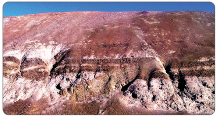
District and project scale structural, geological and alteration mapping. Structural interpretation of geological maps and characterization of structural types and architectures.
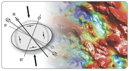
Structural Analysis
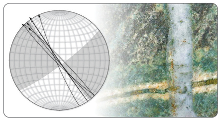
Stress reconstructions and cross-cutting analysis of fault/fracture and vein arrays. Interpretation of fault/fold geometries and cross-section construction and balancing.
Geophysical Data
Deposit Characterization
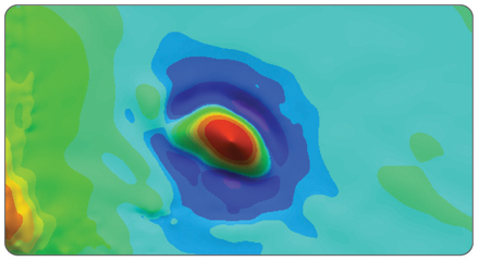
Magnetic and geolectrical characterization for mineral deposits pattern recognition and targeting.
Structural Interpretation and Analysis
Magnetic, gravity and radiometric data interpretation for structural mapping and mineral deposit control.
Satellite Images and Topographic Data
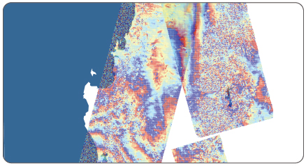
Satellite Image Interpretation
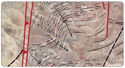
Geological and structural interpretation of satellite images for structural styles characterization and geological units and alteration zones mapping.
DEM Interpretation and Analysis
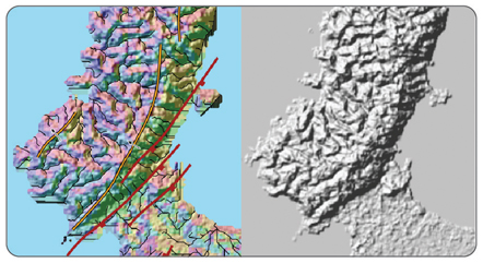
Satellite image and Digital Elevation Data (DEM) interpretation for tectono-geomorphology analysis.
Seismic Reflection Interpretation
2D and 3D Seismic Reflection
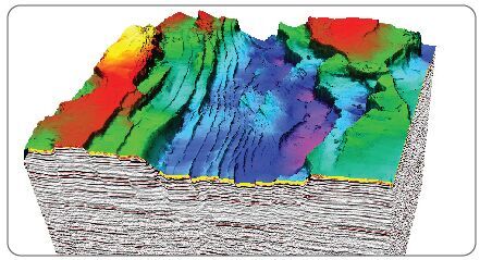
Structural and stratigraphic analysis of 2D and 3D seismic reflection and well data, from generation of plays and leads to definition of complex traps.
Seismic Attributes and Filtering
Post-stack processing and calculation of seismic attributes for enhanced subsurface imaging.
Geodesy and Crustal Deformation
Satellite-based geodetic techniques for modelling deformation
Integrated monitoring of surface deformation anomalies, seismicity, and stress distribution.